Putney Permaculture Map
Designer09/2024-11/2024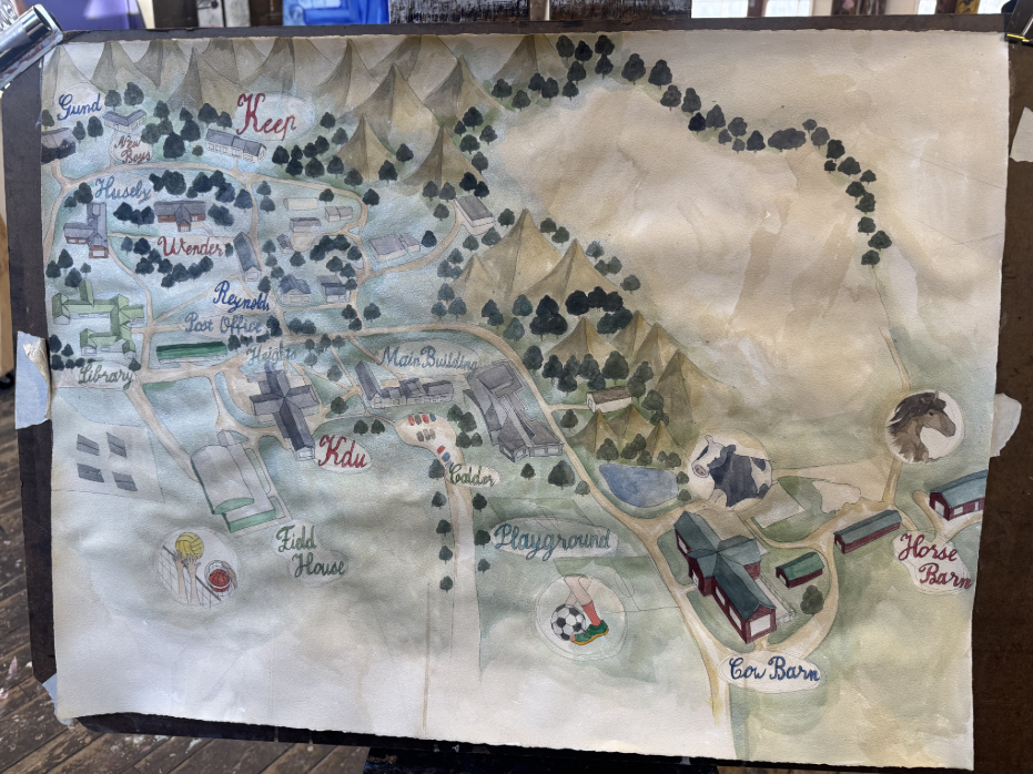
The Idea
When I first arrived at Putney, the size of the campus made it difficult to remember the names and locations of different buildings. That experience inspired me to create a map that could help new students understand the campus more easily.
Exploring the Campus
I explored the campus and studied its different spaces, from academic buildings and dormitories to athletic facilities, barns, and natural areas. I also looked at the campus through the idea of permaculture zones, considering how frequently different spaces are used and how much human activity and maintenance they require.
The final map includes major locations such as the Main Building, Calder, KDU, Field House, Library, dormitories, and the school’s cow and horse barns.
Creating the Map
I chose watercolor to give the map a warm, organic feeling that reflected Putney’s rural environment. Rather than creating a purely functional campus map, I added small illustrations of fields, mountains, cows, horses, barns, and other details that represent everyday life at Putney.
Each location also represents a different part of student life—from studying and performing at the Main Building and Calder to working with livestock at the Cow Barn and Horse Barn.
More Than a Map
This project became more than a wayfinding tool. It was my way of understanding how Putney’s academic, residential, agricultural, and natural spaces connect with one another.
By combining permaculture thinking with illustration, I wanted to create something that could introduce new students to the campus while also capturing the rural character that makes Putney unique.